Dredging Information
MAINTENANCE DREDGING AT NORTH HAVEN
What’s happening:
We will be undertaking routine maintenance dredging at North Haven Boat Marina to achieve the
necessary depths required to maintain a safe and navigable marina for vessels that operate out of North Haven. Work will involve removing sand and seagrass from inside the channel, extending out through the entrance.
How this affects you:
Works are expected to commence in July 2024 and be completed in September 2024. The exact completion date will be dependent on the amount of work required, weather conditions and operating
restrictions.
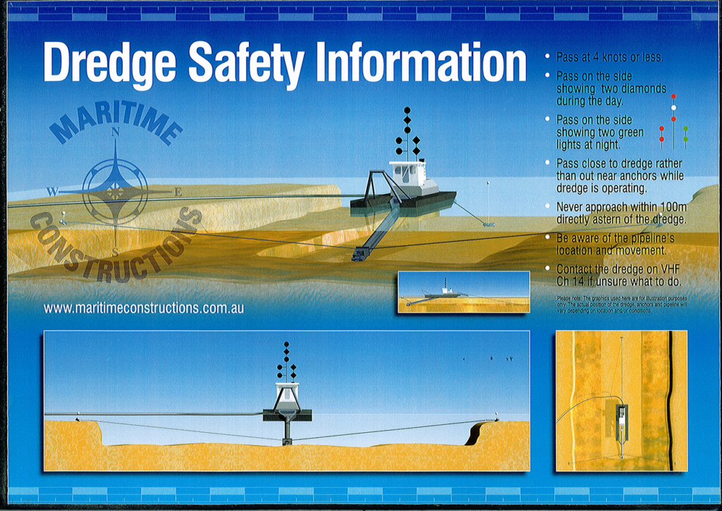
Works may be undertaken for up to 24 hours a day, 7 days a week. There will be strict guidelines for work between 10 PM – 7 AM to reduce noise levels for residents. This activity will not require the closure of the boat ramp. Mariners and boat users will need to comply with the safety rules as displayed at the boat ramp and on the below flyer. A cutter suction dredge will be operational (operating on a three-point mooring system) within the North Haven. Marina and dredged materials will be pumped to the northwest of the dredging site. A single dredge will be positioned facing into the marina with approximately 700-1000m of pipe running to the designated disposal site. Some water discolouration at the disposal site could be expected during the works but will not persist past project completion. These works are undertaken under the Environmental Protection Authority (EPA) guidelines. Normal water quality monitoring will be conducted daily and in accordance with Water Quality Management Plan (WQMP).
ENVIRONMENTAL MONITORING
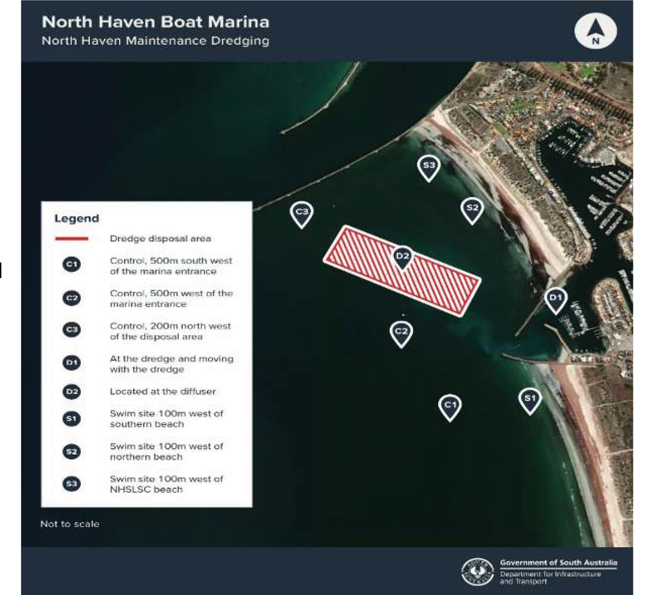
Maritime Constructions operates under a Dredging licence issued by the Environment Protection Authority (EPA). The EPA require dredging operators to follow a project specific EPA approved Dredge Management Plan. This includes water quality monitoring to be undertaken throughout the project in accordance with an approved Water Quality Monitoring Program. The discharge site for the dredged material is located approximately 300m North West (seaward) of the marina entrance. This site will be marked during the works and must be avoided by the general public.
BOATING SAFETY
Boats using the marina entrance are advised to use caution and follow the Dredge Safety Information (see flyer below). A 4 knot speed limit applies within the marina and within 100m of the dredge and discharge pipelines.
MORE INFORMATION
DIT is responsible for this dredging operation and any queries or concerns may be directed to the contractor. Environmental & Projects Manager – Simon Spencer on 0499 777 297
The dayshapes are only for use during light hours. Once dark we don’t expect people to be able to see the navigation shapes and they should be passing on the side indicated with 2 vertical green LED lights. The non pass side on the roof of the wheel house is indicated by two vertical red lights (as per below diagram).